Personal tools
Create account
Log in
Navigation menu
Namespaces
Page
Discussion
English
Views
Read
View source
View history
More
Search
Navigation
Main page
Weapons
Vehicles
Crafting
Structures
Facilities
Lore
Community Guides
Community portal
Recent changes
Random page
Admin noticeboard
Tools
What links here
Related changes
New page
Special pages
Printable version
Permanent link
Page information
Page values
Cite this page
Maps
From Foxhole Wiki
(Redirected from
Map
)
Jump to navigation
Jump to search
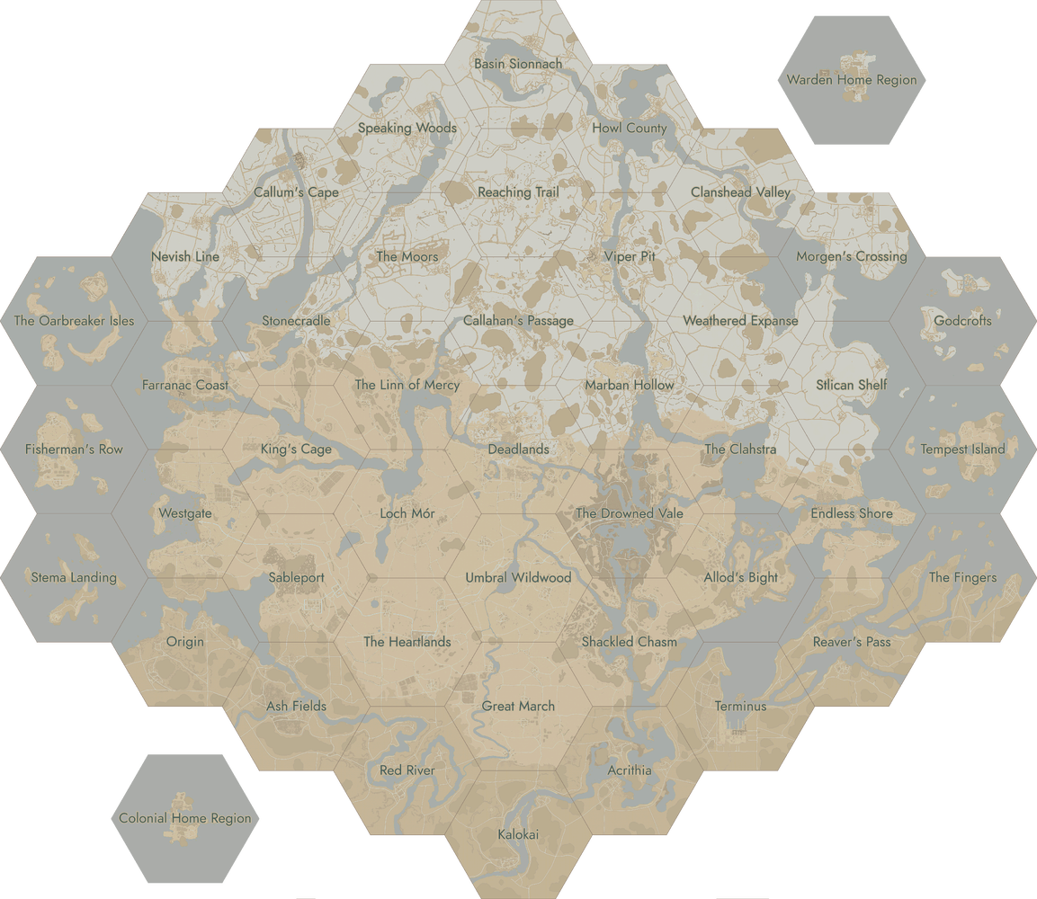
Click on a region to open the corresponding page.
Category
:
Maps
Cookies help us deliver our services. By using our services, you agree to our use of cookies.
More information
OK