Fichier:World Map.png
Aller à la navigation
Aller à la recherche
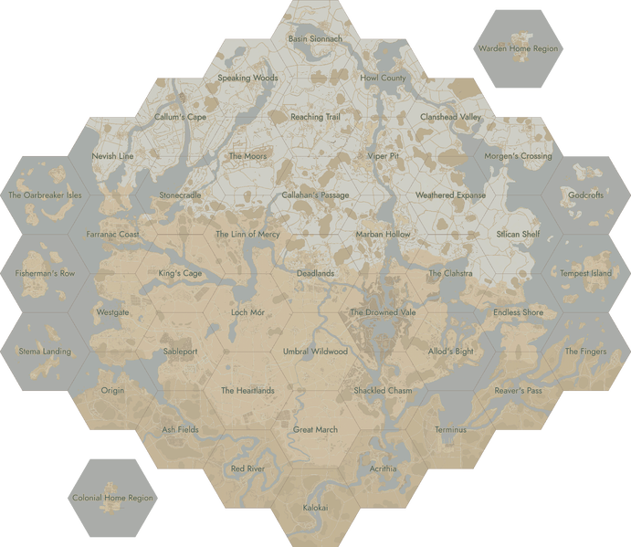

Taille de cet aperçu : 691 × 599 pixels. Autres résolutions : 277 × 240 pixels | 7 168 × 6 216 pixels.
Fichier d’origine (7 168 × 6 216 pixels, taille du fichier : 6,91 Mio, type MIME : image/png)
Historique du fichier
Cliquer sur une date et heure pour voir le fichier tel qu'il était à ce moment-là.
| Date et heure | Vignette | Dimensions | Utilisateur | Commentaire | |
|---|---|---|---|---|---|
| actuel | 30 mars 2024 à 21:05 | | 7 168 × 6 216 (6,91 Mio) | Secretpedia | |
| 5 décembre 2023 à 20:24 |  | 7 168 × 6 216 (6,79 Mio) | Secretpedia | ||
| 2 novembre 2023 à 19:07 | 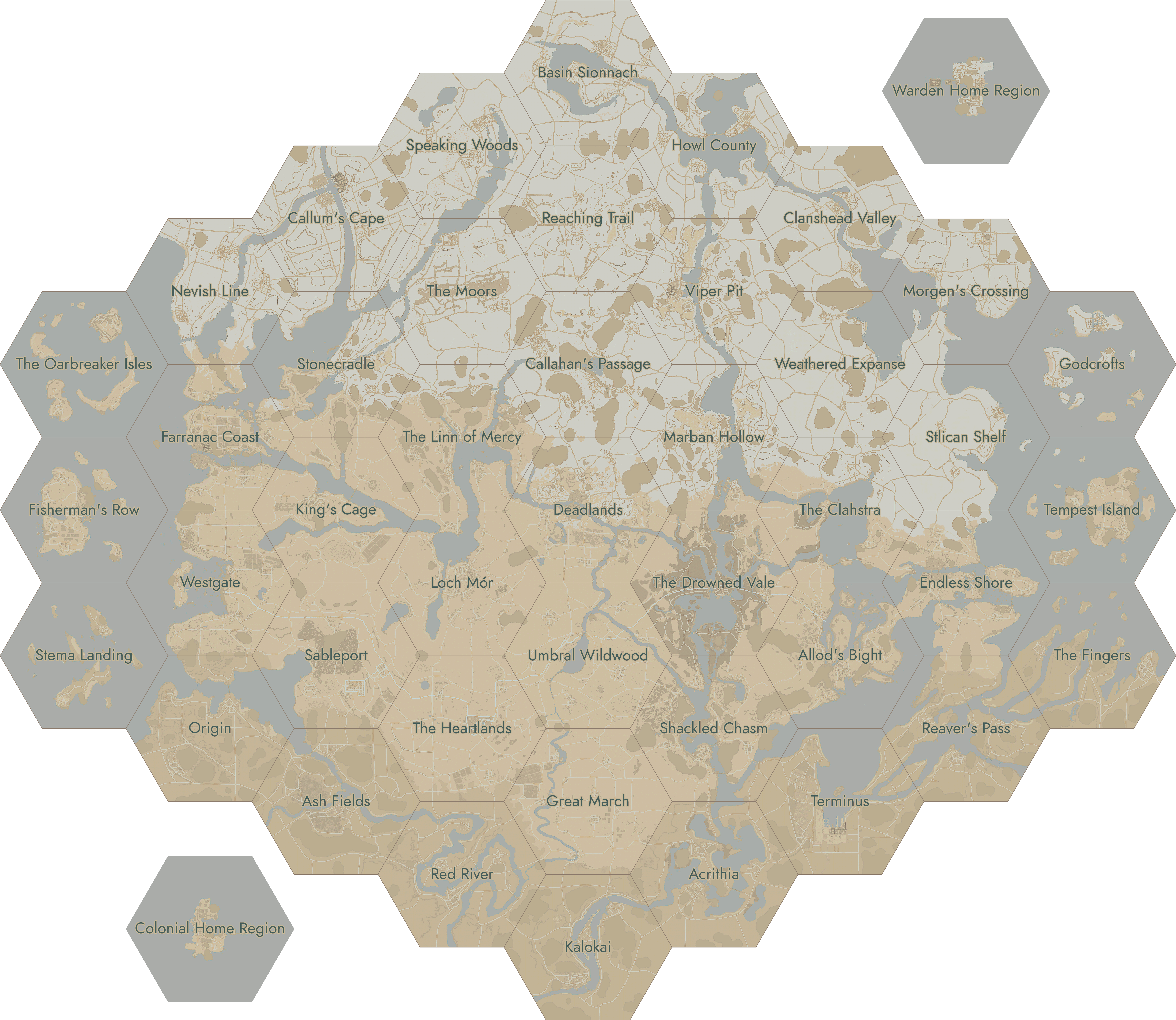 | 7 168 × 6 216 (6,79 Mio) | Secretpedia | ||
| 25 octobre 2023 à 16:43 |  | 7 168 × 6 216 (6,79 Mio) | Secretpedia | ||
| 24 octobre 2023 à 19:08 |  | 7 168 × 6 216 (6,79 Mio) | Secretpedia | ||
| 22 octobre 2023 à 00:06 |  | 7 168 × 6 216 (5,36 Mio) | Secretpedia | ||
| 11 octobre 2023 à 09:18 | 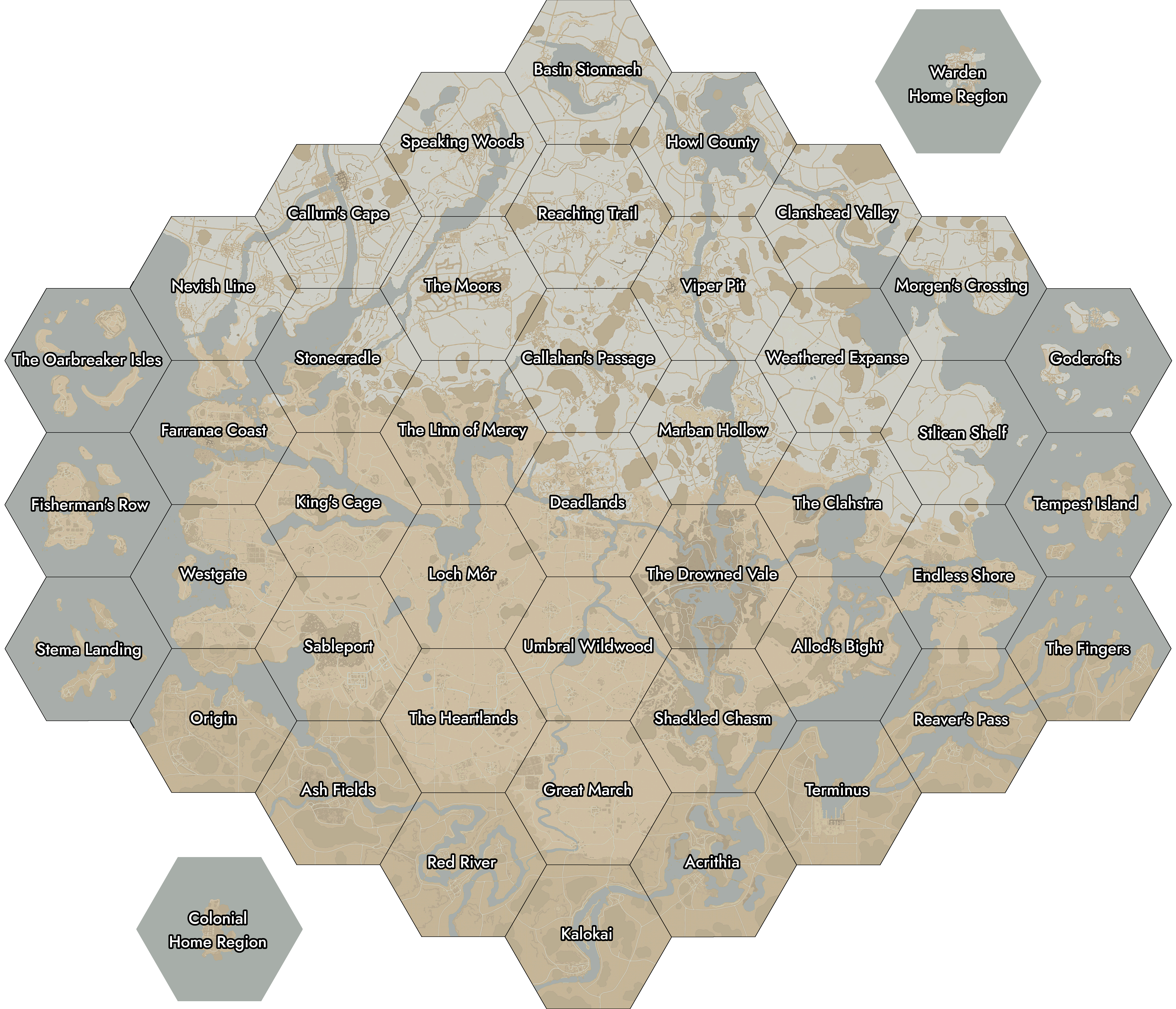 | 7 244 × 6 216 (6,92 Mio) | Nextra123 | update 1.54 | |
| 12 juin 2023 à 22:42 | 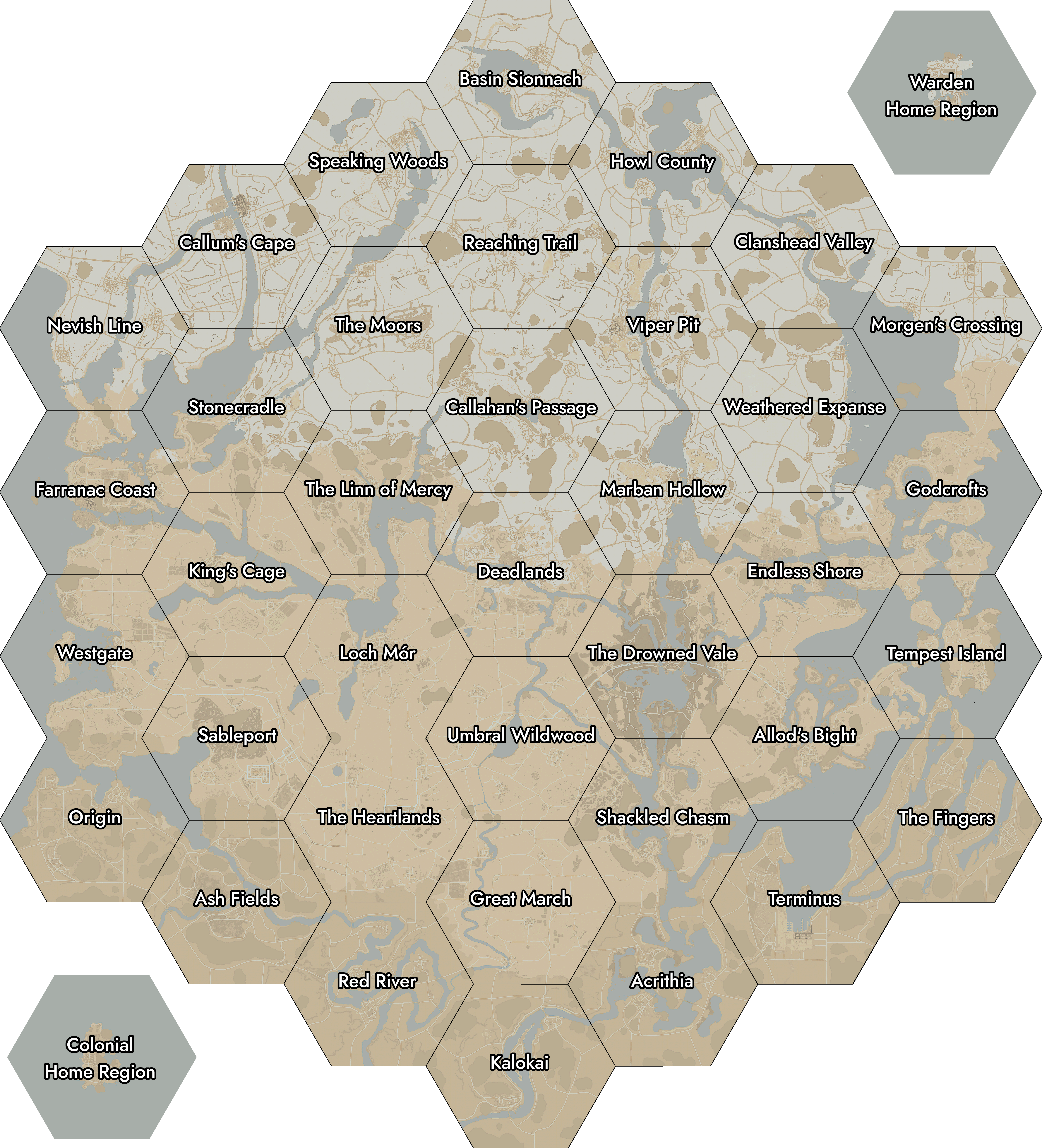 | 5 644 × 6 216 (6,48 Mio) | Nextra123 | update 53 | |
| 23 mars 2023 à 04:54 | 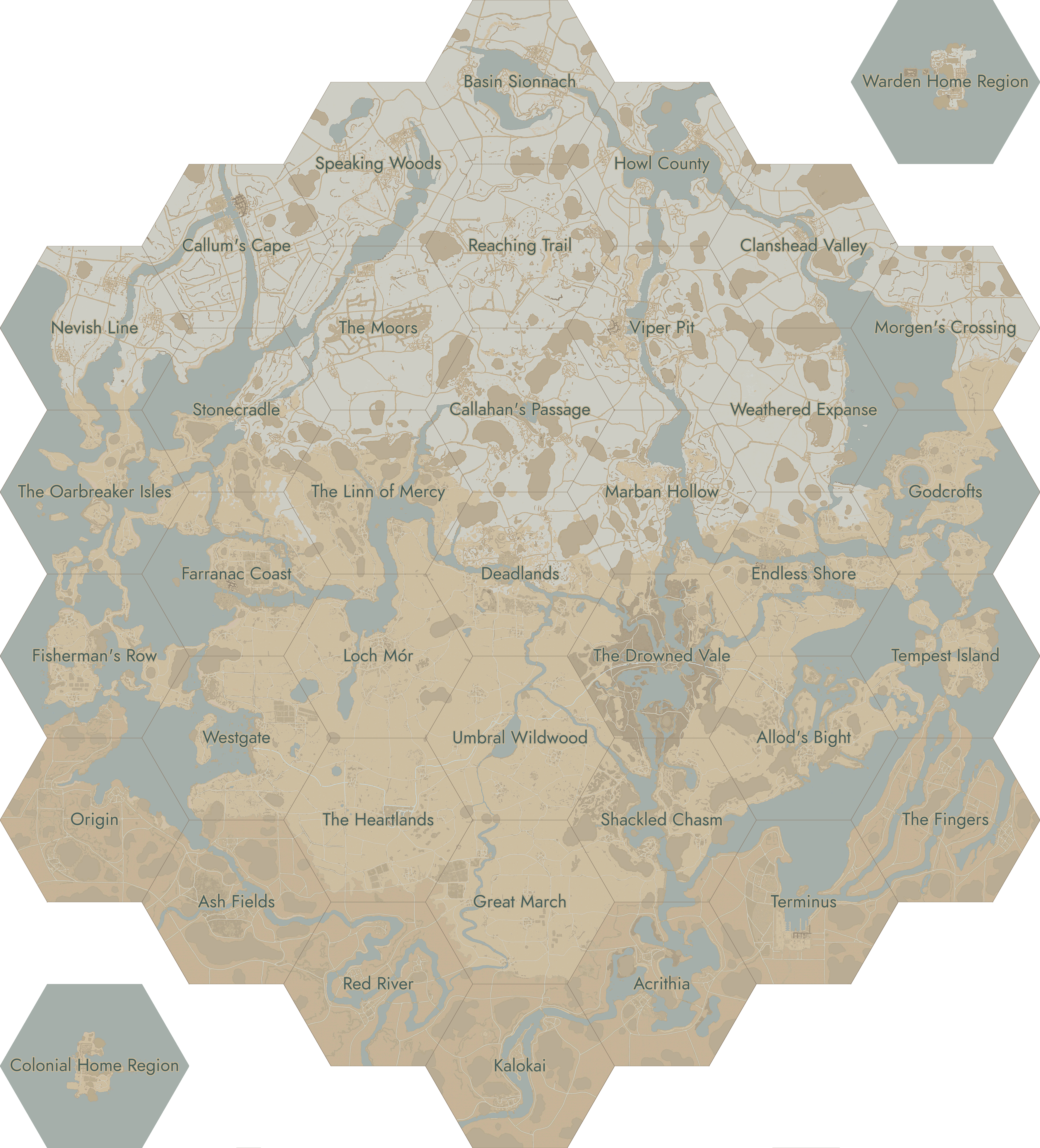 | 5 632 × 6 216 (5,2 Mio) | Secretpedia | ||
| 28 novembre 2022 à 18:36 | 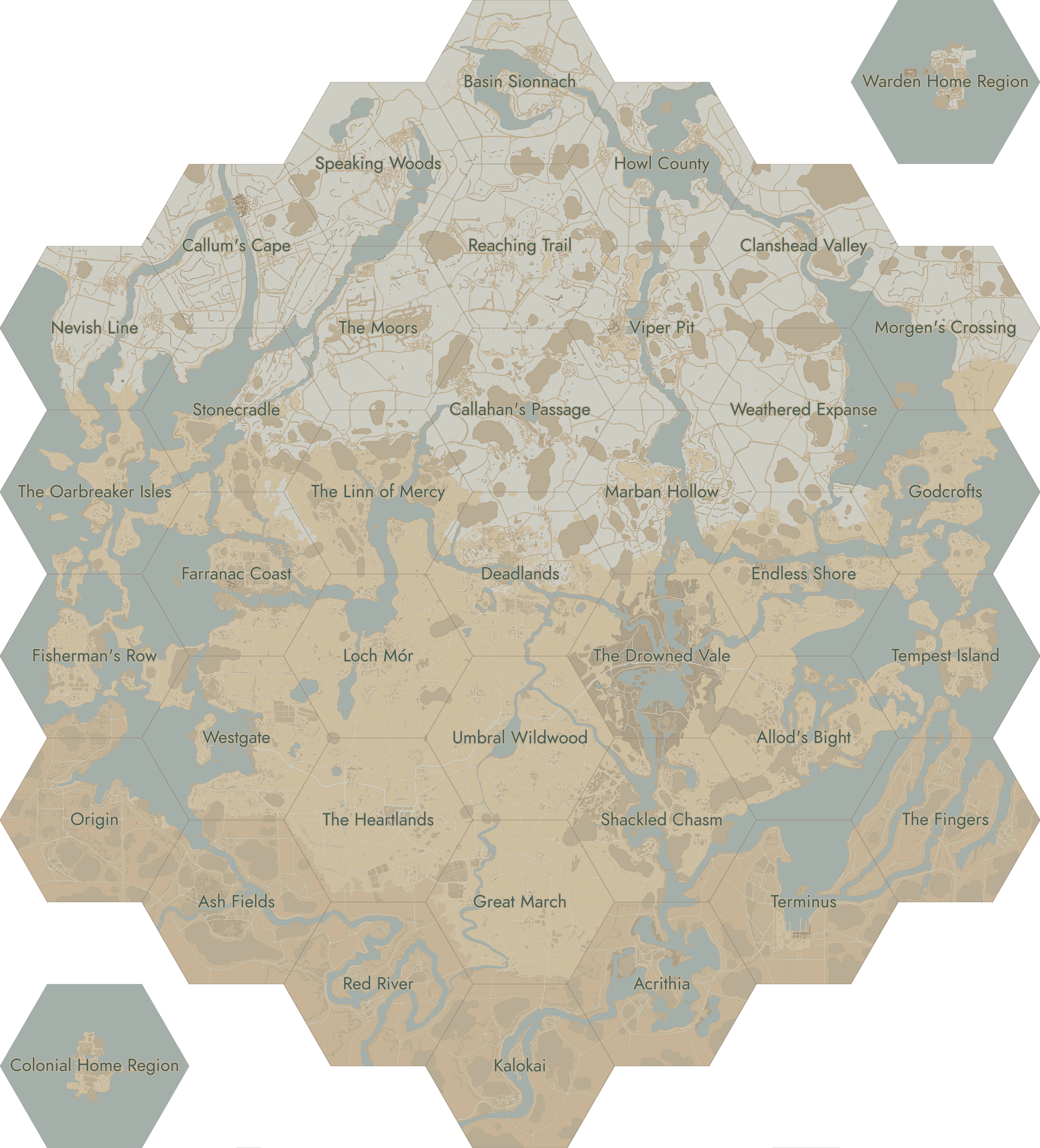 | 5 632 × 6 216 (5,17 Mio) | Pcj |
Utilisation du fichier
Les 44 pages suivantes utilisent ce fichier :
- Acrithia
- Allod's Bight
- Ash Fields
- Basin Sionnach
- Callahan's Passage
- Callum's Cape
- Cartes
- Clanshead Valley
- Endless Shore
- Farranac Coast
- Fisherman's Row
- Foxhole Wiki
- Foxhole Wiki/Section 4
- Godcrofts
- Great March
- Howl County
- Kalokai
- Loch Mór
- Marban Hollow
- Morgen's Crossing
- Nevish Line
- Origin
- Reaching Trail
- Red River
- Région d'origine
- Régions
- Shackled Chasm
- Speaking Woods
- Stonecradle
- Tempest Island
- Terminus
- The Deadlands
- The Drowned Vale
- The Fingers
- The Heartlands
- The Linn of Mercy
- The Moors
- The Oarbreaker Isles
- Umbral Wildwood
- Viper Pit
- Weathered Expanse
- Westgate
- Zones de région
- Modèle:Maps Navbox